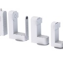
Automatic Takeoff and Landing (ATOL) Tracker
IMAGO ATOL SYSTEM OUT-PERFORMS OTHER AUTOMATIC LANDING SYSTEMS FOR UAVs
THE NEED FOR AUTOMATIC LANDING SYSTEMS
Automatic Landing Systems (ALS) offer substantial advantages for Unmanned Arial vehicles (UAV). The main advantages are
- More reliable, precise operation,
- less risk of human error / damage to the UAV
- smaller landing area
Other advantages are more precise guidance of UAV, avoid training effort for external pilots, less flight noise in training area, fast and easy deployment, reliable during day, night, rain and snow, reliable data of the actual UAV position, quick turnaround of UAV for next mission, video imagery of the UAV flight.
WHY NOT USE A RADAR SYSTEM?
Video trackers and scanning laser systems are passive technologies and have advantages over RADAR systems
- Minimal equipment on the UAV
- More Cost-effective system for UAV landing
- Difficult to detect (no electromagnetic fields or interferences)
WHY NOT USE A SCANNING LASER SYSTEM?
Imagos ATOL (Automatic Take Off & Landing) system offers significant advantages over scanning lasers such as RUAG
- Much easier to acquire the target (wider field of view, higher tracking rates and longer range acquisition)
- Track faster targets
- More accurate
- Track at longer ranges
- Track at higher elevations
- System is never caged so more robust target re-acquisition in poor weather, etc
KEY IMAGO CHARACTERISTICS
Camera and eye-safe laser on a pan/tilt unit at end of run way
Video tracker detects and tracks UAV. Laser only used for range measurement
Many less laser drop-outs so better all-weather performance
Only equipment on the UAV is a small reflector
Camera and tracker can be supervised on the computer screen of the Ground Control Station
The landing process is started when the UAV enters a predetermined window in the sky. This is a much wider window than for laser scanner systems so easy to navigate.
The tracker is never caged so can easily re-acquire target if laser signal drops out
UAV position is measured continuously from 10 km range and at a high update rate for precise control and improved robustness to laser drop-outs in poor weather
The measured position is transmitted to the Ground control Station, processed and used to control the UAV on its glide path via a data uplink to the UAV until the end of the landing phase.
|